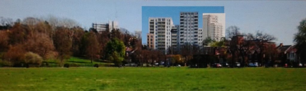
Proposed buildings ruin the protected view from Queens Mead
The view of the town centre – or rather the trees – from Queens Mead and the railway line, is protected.
Two developments will ruin this view : the S2 application to put 16 storeys in place of the former Maplins neo-georgian shop [planning here] and Churchill Quarter [planning here]. Please write and object to these so we do not loose the lovely view our council is supposed to protect.
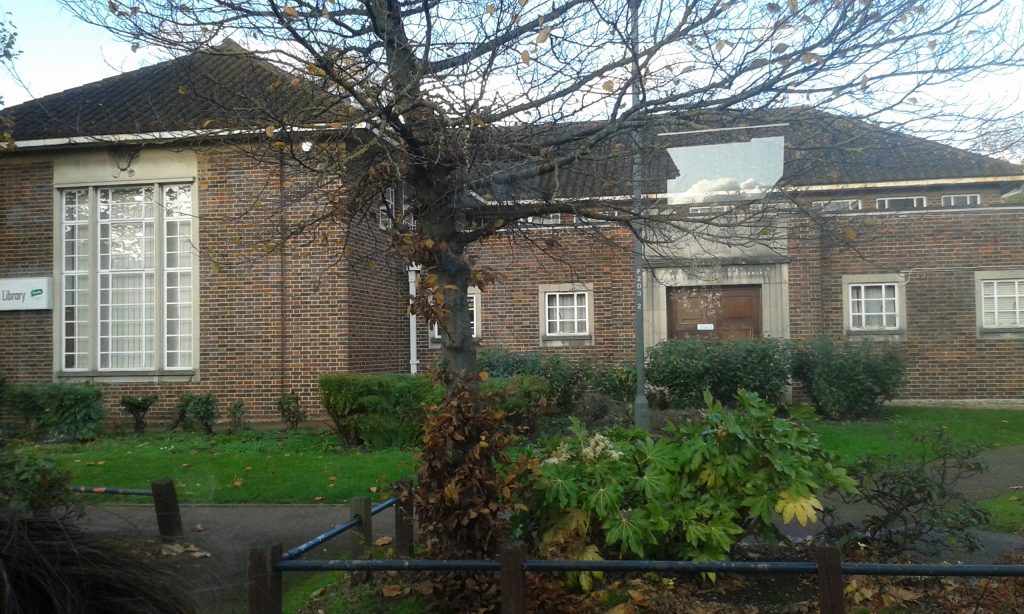
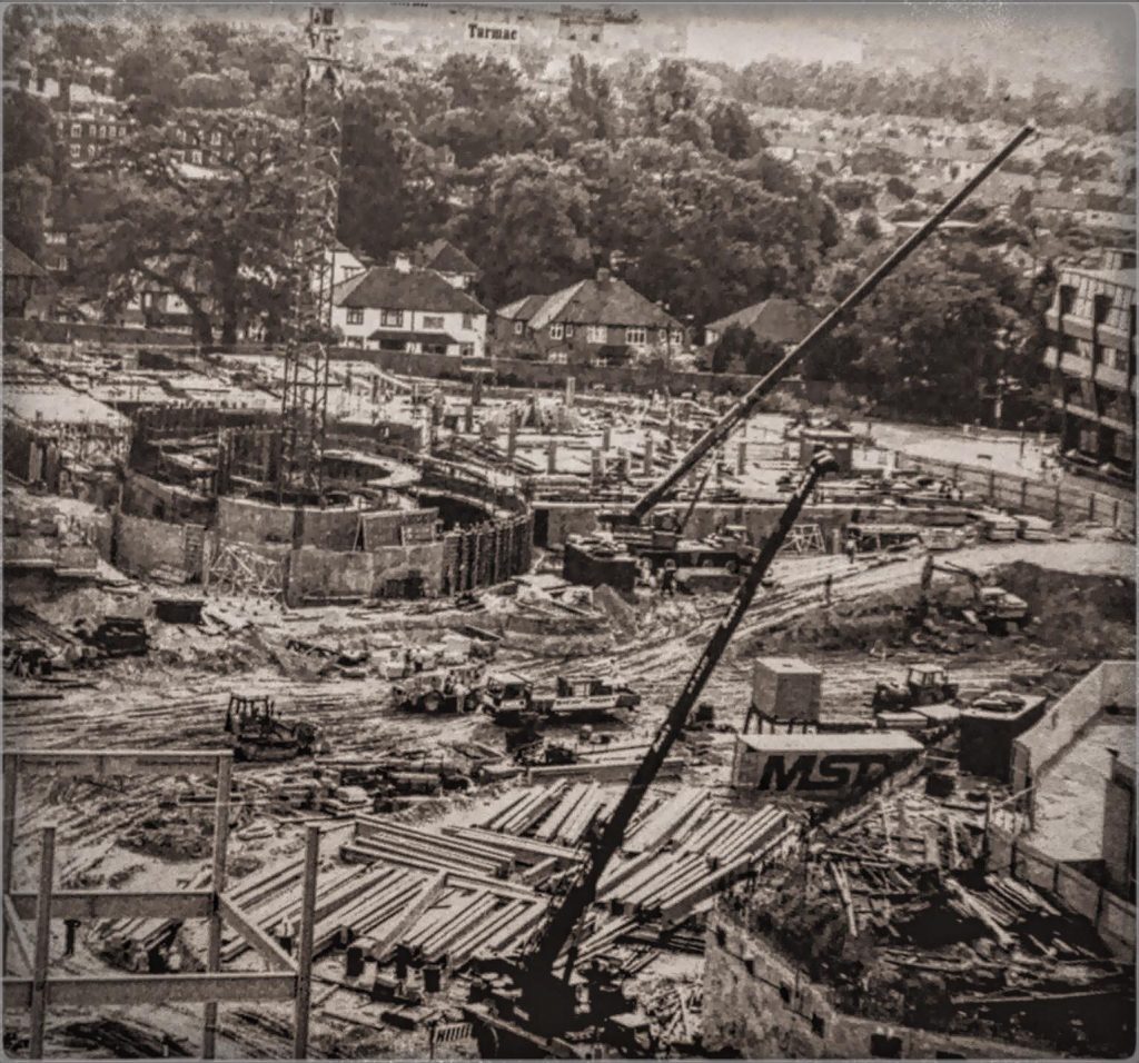
Like the sale of Civic Centre land the Council’s proposed demolition of the Beckenham Library for a block of flats is another example of the Council flouting its own heritage protection policies in a misguided attempt to meet housing targets.
The issue has been front page news several weeks running. The Library is identified as key building in the Beckenham Elm Road Conservation Area designated by the Council and as such carries a presumption for its preservation in local and national policy. Primary legislation Section 72 of the Listed Buildings and Conservation area Act requires a local authority to ‘pay special regard to the desirability of preserving or enhancing the architectural or historic character or appearance of a Conservation Area ‘ in the exercise of any of its planning functions. So far it would appear the Council have not paid any regard to their statutory duties as custodians of the historic environment.
Like the Civic Centre issue it has gone through a number of committee stages without any reference to its conservation area and a feasibility study for replacement flats has already been commissioned and approved in principle! Needless to say the civic society is supporting the Library Action Group in their efforts to save this building from the wreckers!
Posted inArchive|Comments Off on Archive: Beckenham Library – outline approved despite Conservation Area
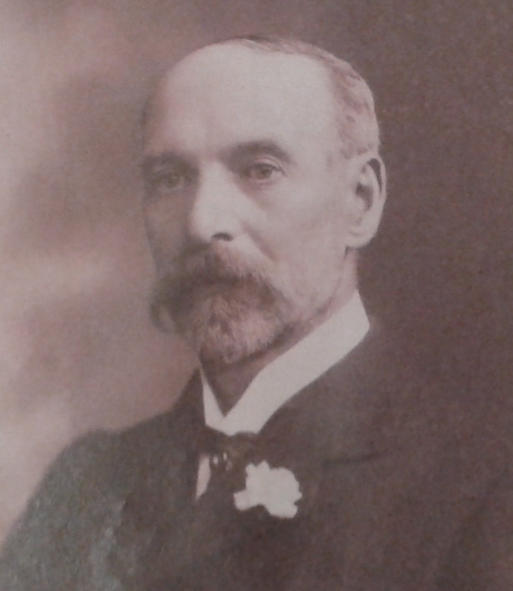
It has been good to welcome a branch of Robert Dyas now open in Bromley High Street and even more so since it has been discovered by staff at the Local Studies Library that Robert Dyas lived for the last 30 years of his life in Blyth Road, just off Beckenham Lane, in the Town Centre.
This year’s Christmas Lights in Bromley: the Christmas Tree in Market Square
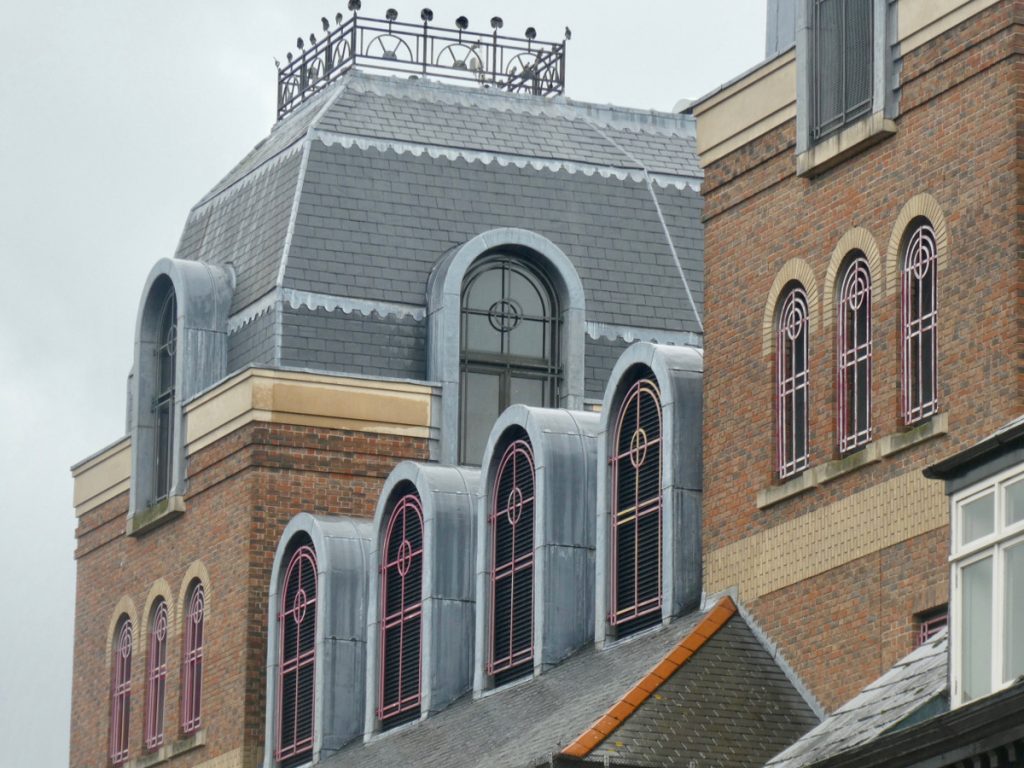
This year, some of our heritage buildings have been flood lit on High Street, and it is well worth taking a trip in to look around them. The installation is by BID/Your Bromley, and Workmen have been busy installing the lights, by cherry picker, for months (your author had wondered why so many security lights were suddenly needed…) Here’s some of the history behind the buildings that are beautifully lit up this year:
Bromley built the Glades in the 1980s, demolishing houses, the non-conformist church, and shops to make way for it. They sold part of Queen Gardens so that the remanent was blocked off from Market Square.
The new bypass curved round behind it, but alas, the shopping centre was opened for Christmas 1988, months before Kentish Way was completed, so the traffic jams were monumental.
The Glades with decorative windows and tracery
Whatever the community had to sacrifice for our shopping centre, it is undeniable that Bromley would not be the same if it had not been built. And, it is a quality build that, thankfully, left brutalism behind, and has a style, that is not pastiche (heavens forbid) but is all of its own, borrowing elements from other heritage buildings in the town centre.
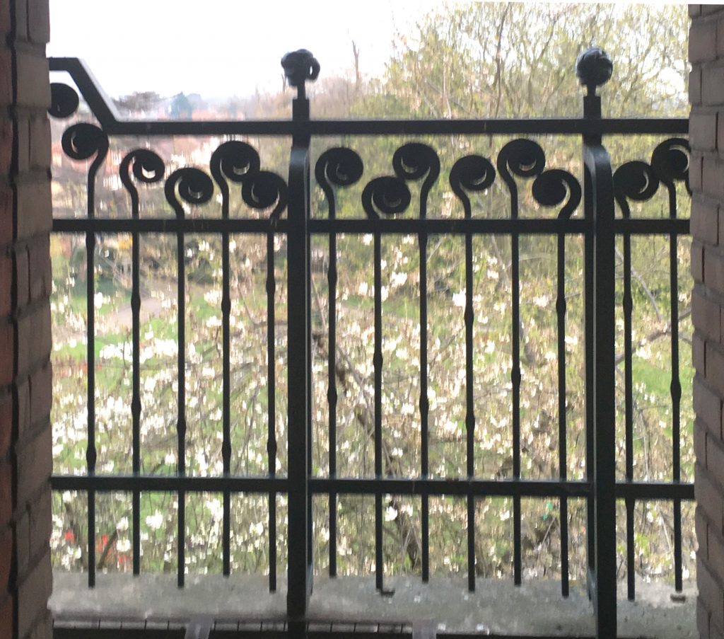
As it was called the Glades from the outset, the details of the building are themed: the arch on the high street is in green granite, the balustrades on the balconies are stylised trees, the railings of the car park balconies look like abstract fern shoots.
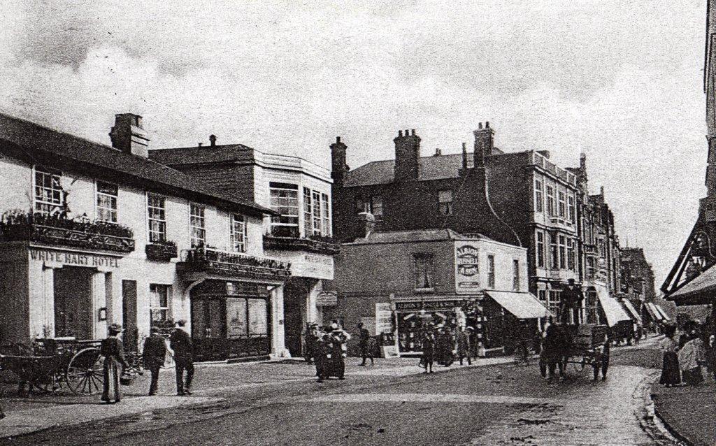
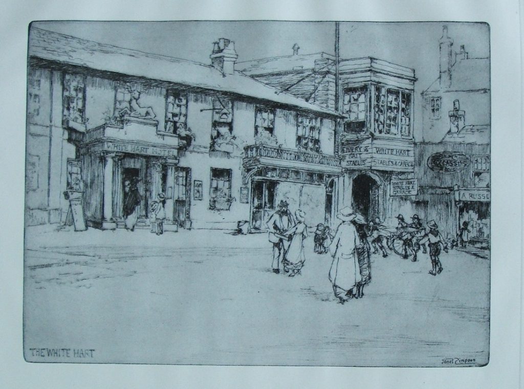
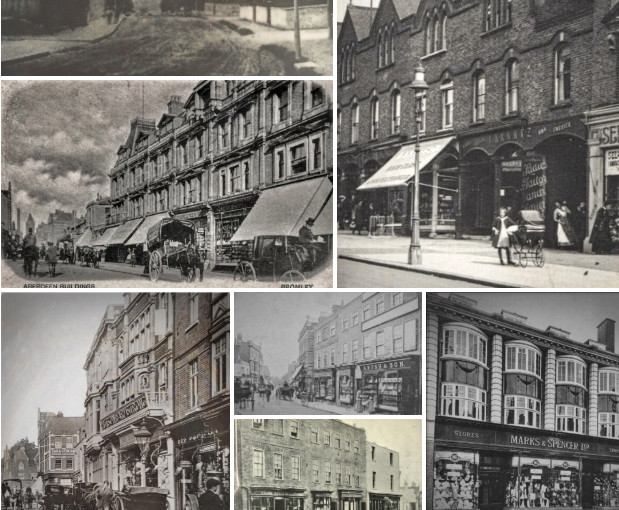
This building had a long history and this post is only a summary. The White Hart is the badge of king Richard II who reigned from 1377-99, so it is thought that there has been an Inn or public house at this site, since this time. There are references to it in the 16th Century and records of it being sold in the 18th century.
1900s street scene
In the 1830s it was partly rebuilt and extended, becoming the premier coaching inn with assembly rooms. It was a community hub for that century, having auctions, being a court house for Petty Sessions and Crown Court, hosting County Balls and was the headquarters of the Voluntary Fire Brigade.
It was demolished in the 1960s to build the current ugly brutalist building. With low profile and extending a long way back, it not just looks bad, but a poor use of space.
The White Hart had a field behind it, that the town used as a cricket pitch. Part of it has become Queens Gardens and this is where HG Wells had a life-changing accident. His broken leg mended, but the books he read in his covalence inspired his future writing career. More details on our page here.
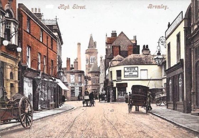
An etching by Janet Simpson in 1909Postcard with Island shops, New Old Town Hall and White Hart Inn in the centre
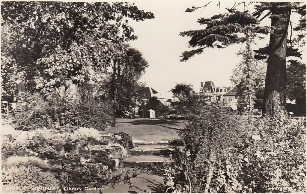
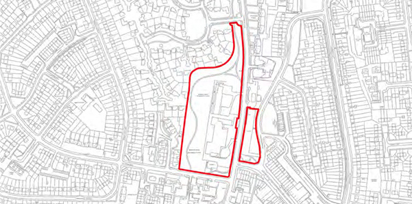
These two parks are really one; it is just a historical note that Library Gardens is the level area behind the Churchill Theatre; you then go down the slope to the integrated Church House Gardens.
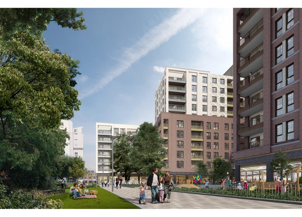
In this proposal, tower blocks of SIte G, ‘Churchill Gardens’ loom over the remnant of Library Gardens.
Note that, part of this site, including the public conveniences (which the council has locked up for years) will be sold to the Site G development. Current proposals save the Deodore Cedar tree. The side of the new development will open out onto the fragment of park remaining.
Library Gardens
Library Gardens was originally the gardens for Neelgherries House, and there’s an account of it’s history at the Friends Page, that the high street facing villa was purchased by George Sparkes, on retirement from working in Nilgiris (spelling has changed) and was bequeathed as a pleasure garden by his widow in 1900. It was laid out by Mr J Stenning, and opened in 1906. The house was replaced by the Carnegie Library and later demolished for the current Churchill Theatre and Library.
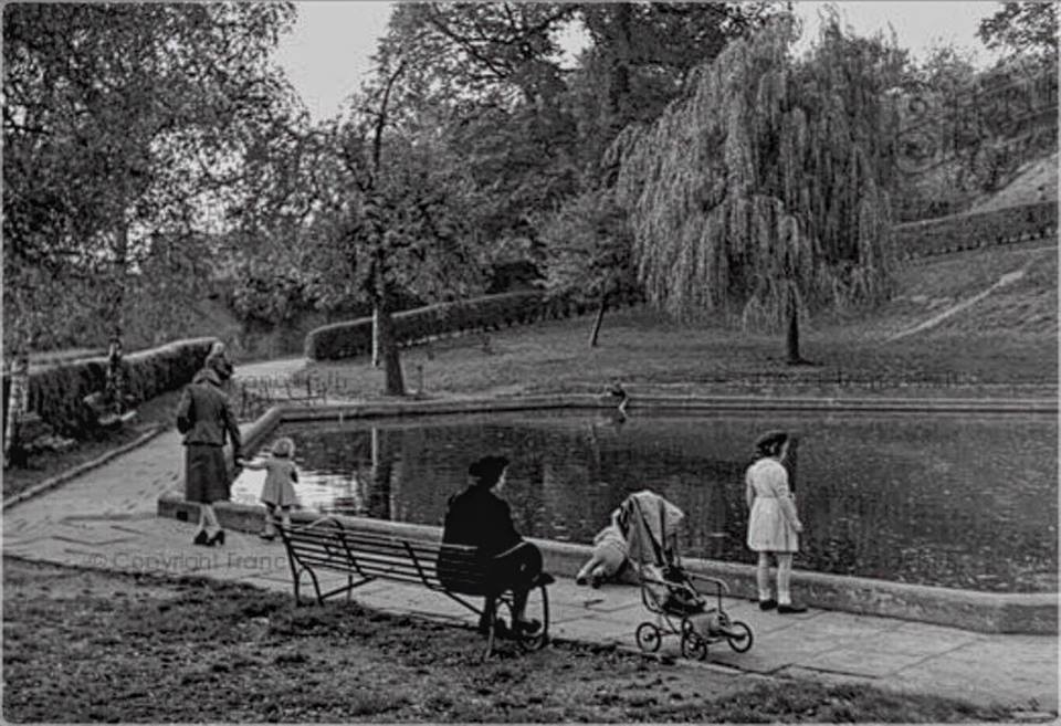
Boating lake, now a sand play ground, in 1948.
Church House Gardens were laid out by Abel Moysey from 1832. The Park Friends page explains that it was purchased by the council in 1926, and combined with Library Gardens in 1930. Some of the beloved features (eg the amphitheatre) were created as 1930s work schemes in the Great Depression. Both parks are showing signs of neglect in recent years.
The Model Boat pond now the Sandpit: the current children’s sandpit area was originally a model boat pond built in 1933 as one of the park features built in the Bromley Unemployed Works Scheme – thus the lovely tiles with ‘Rotterdam’ and other north sea ports on them. Then it was remodelled as a paddling pool in the early 1980s before the current, popular incarnation.
The Flower Clock: Traditionally Library Gardens was a much loved formal garden with a flower clock, the hands of which were set to the Library closing time.
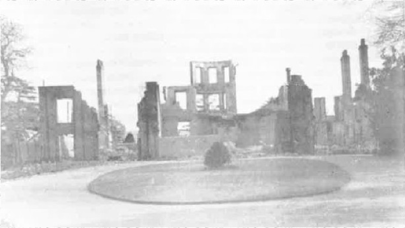
The house was gutted in a devastating German bombing raid on 16th April 1941
Church House (whose gardens form the park) was lost in WW2 bombing: “Church House was a command centre for the Royal Observer Corps and it had been manned day and night since August 1939. As flames engulfed the house, fired by a stick of incendiaries, the men wisely abandoned their post and sought shelter. Firefighters got close to the scene but could not help because Church Road had been blocked by the ruins of the parish church. This well known mansion was virtually obliterated.” (from the Observer Corps)
The Rockery, Church House Gardens (2019)
The Rockery: London Parks and Gardens post says: “The large rockery below the terrace was created in the early 1950s from masonry reclaimed from the bombed-out parish church, and amongst the plants remnants of fluted columns, stone masons’ marks and sculpted quatrefoils can be seen“. Unfortunately this area has become unkempt and the remains are no longer visible under the rampant ivy.
The Bandstand. Originally a thatched bandstand on a little island, which was vandalised; then a roofed concrete performance stage was built opposite the amphitheatre. This became derelict and the roof was removed, though the base area was still used. Then the bottom area of the amphitheatre was filled in, instead, and the base allowed to become derelict too. Please see the full description on the Friend’s site, here.
Part of this park, Dickerson’s Copse., might be chopped down for the Site G proposals.
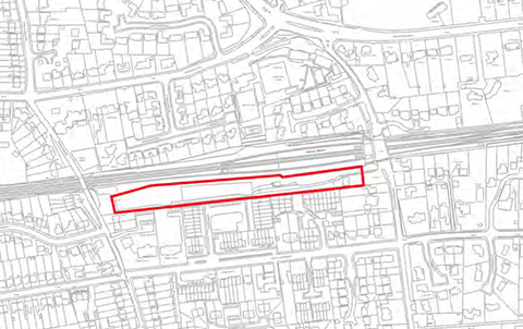
S2 Estates have put in an application for a 16 storey tower on the site of the former Maplins store. Their supporting statement said that they felt it would help locals find the High Street.
66-70 High Street, lovely example of a Neo Georgian Shop
This1932 neo-Georgian shop is one of only 2 buildings considered good enough to be worth saving in the proposed Master plan of the lower high street.
This proposal is much higher than the surrounding buildings (16 storeys compared with 2 or 4) , overbearing, and will stick out for miles around (being on the ridge top).
This area already suffers from inadequate infrastructure – shortage of GPs, overcrowded stations – and these units would be better built on sites that are walking distance from one of the other 16 railway stations in the borough.
S2 Estates have ignored the feedback from their public consultation and pushed ahead with their over-sized development.
This is the oldest section of the High Street, and has buildings that survive from the 1700s. The town is very fortunate that there we have a fine collection of Victorian and Arts and Craft era buildings in this part of our High Street.
Posted inhistoric_link_page|Comments Off on Heritage Buildings of the Upper/North High Street
Sites 4 and 5 are situated just south of the town centre.
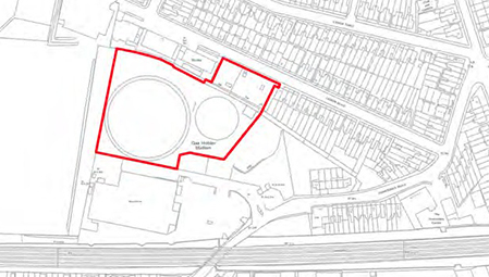
The ‘Gas Holder’ site on B265 Homedale Road. Together with Tescos (the building to the south) it formed the Victorian town gas manufacturing site.
Site 4 is where the builders merchant Travis Perkins intend to open a store. The initial plan was to provide 120 dwellings with 60 on a platform over the store. In the author’s view, this is a bad location for this type of business, with a low bridge on the B265 to the south and narrow roads to the north. Not just will timber delivery lorries have problems but the customers will have their own vans/pickups to negotiate the road. The company has successfully reduced the number of housing units saying the platform is too expensive. They have now also decided that the land will not be decontaminated sufficiently for the 60 domestic units, and would like to build just 12 executive houses on the north side. They do not intend to share their store access onto the B265 Homesdale Road with the housing, making the access on the too-narrow Canon Road.
Site 5 is a thin stretch of land by Bickley Station.
Site 6 is Bromley Gym site in St Paul’s Cray.
This development seems to include an area of parkland next to the existing buildings, but this is really outside the town centre area.
Site 7 was Orchard Lodge on William Booth Road, in Penge.
Site 8 was Bassetts Campus, Broadwater Gardens, in Orpington.


 Browse our old photos, in
 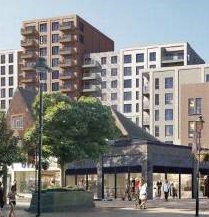 from being dominated by tower blocks: Look here and email our ward councillors about:
*
from being dominated by tower blocks: Look here and email our ward councillors about:
*