Join us! Help promote & protect our Heritage
HISTORIC BUILDINGS
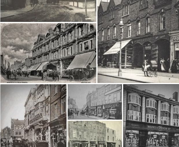
OLD PHOTOS
 Browse our old photos, in
Save our Town Centre
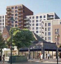
 from being dominated by tower blocks: Look here and email our ward councillors about:
* High rises in the Local Plan
* housing and a hotel on the civic centre (old palace)
and
* 16+ high rises from the draft Master Plan down the Lower High Street
* and there's others...
Follow us on Twitter
BCS tags
- 66-70 High Street (6)
- 2019 Local Plan Site (5)
- AAP (10)
- Art Deco (7)
- Arts And Crafts Movement (12)
- BCS events (6)
- Bromley Council (7)
- Bromley history (8)
- Bromley Palace (6)
- Bromley Palace Park (9)
- Broom Time (3)
- Campaign (15)
- Church House Gardens (5)
- Churchill Theatre (3)
- development (6)
- Former Magistrates Court (3)
- Green space (9)
- guided-walk (7)
- heritage (11)
- Heritage Buildings (49)
- HG Wells (6)
- High Street (19)
- High Street (North) (18)
- LBB-Bromley-North-Trail (20)
- Local Plan (10)
- Lost-Heritage (4)
- Market Square (14)
- Old Bishops Palace (3)
- Old Photos (8)
- parks (3)
- Picture_House (3)
- planning (16)
- Protected View (4)
- Pulhamite (4)
- Queen's Gardens (4)
- Self-Guided Heritage Walk (15)
- Site 10 (3)
- Site G (12)
- South Street (3)
- SPD (10)
- SPD Consultation (11)
- St Blaises Well (4)
- Supplementary Planning Document Consultation (3)
- town-centre-park-trail (12)
- Town Hall (4)
Category Archives: the Cage Field triangle streets, named after compass points
Heritage Buildings – West Street 03: former post office
Architect: Henry Tanner The former Post Office in West Street was completed in 1896, and like the David Greig building facing it across Market Square, uses prefabricated decorative ceramic faces – in this case, terracotta. These facings were not just … Continue reading
Posted in the Cage Field triangle streets, named after compass points
Tagged Henry Tanner, Heritage Buildings, LBB-Bromley-North-Trail
Comments Off on Heritage Buildings – West Street 03: former post office
No. 19 East Street (former Local Board)- Heritage Building Profile
Number 19 East Street was formerly the offices of the Local Board (the first body of local administration in Bromley). It stood at the junction of East Street and West Street. The purpose of the local board was to provide … Continue reading
Posted in the Cage Field triangle streets, named after compass points
Tagged East Street, Heritage Buildings, LBB-Bromley-North-Trail, Old Photos
Comments Off on No. 19 East Street (former Local Board)- Heritage Building Profile
The Old Drill Hall (now O’Neils) – Heritage Building Profile
The Drill Hall, Nos 27-29 East Street, was opened in 1872 for use by the Bromley Volunteer Rifle Corps. Town celebrations and events were held here. It became a public house in 1997. x
Posted in the Cage Field triangle streets, named after compass points
Tagged East Street, Heritage Buildings, LBB-Bromley-North-Trail, Old Photos
Comments Off on The Old Drill Hall (now O’Neils) – Heritage Building Profile
Bromley North Station – Heritage Building Profile
Sometimes called Bromley’s ‘Toy Town’ station. The current building dates from when the station was rebuilt, in Neo-Classical style, in 1925. The original timber buildings which formed Bromley North had become shamefully run down. It was designed by the Chief … Continue reading
Posted in the Cage Field triangle streets, named after compass points, Tweedy Rd
Tagged Heritage Buildings, James Robb Scott, LBB-Bromley-North-Trail, Neo-Classical, Tweedy Road
Comments Off on Bromley North Station – Heritage Building Profile
The Railway Tavern Public House – Heritage Building Profile
The Railway Tavern Public House was built in 1879, by Berney & Sons who also designed the Star & Garter public house in the High Street. On the side facing the station, there’s a panel with the initials N & … Continue reading
Posted in Arts And Crafts, the Cage Field triangle streets, named after compass points
Tagged Arts And Crafts Movement, Berney & Sons, Heritage Buildings, LBB-Bromley-North-Trail
Comments Off on The Railway Tavern Public House – Heritage Building Profile

